.png)
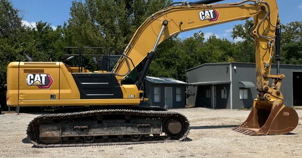
North Texas development hasn't slowed down. From the massive residential buildout in Celina and Aubrey to commercial pad sites along the US-380 corridor in McKinney and Princeton, grading contractors are being asked to do more ground in less time — with tighter tolerances than ever. GPS and machine control technology has moved from a competitive advantage to a practical necessity on these larger projects, and we're seeing the shift clearly in what contractors are asking for from our rental fleet here in Denton.
This isn't about adding expensive technology for its own sake. It's about producing better work faster in conditions that fight you every step of the way — summer heat above 100°F, clay that turns to grease when wet and concrete when dry, and caliche that surprises even experienced operators. Understanding how CAT's machine control systems work, and when they make sense to use, is worth the time for any contractor moving serious dirt in this region.
Key Takeaways
- CAT Grade with 3D GNSS reduces blade passes by 30-50% on finish grading, directly cutting fuel costs during North Texas summers when equipment already runs harder
- Machine control eliminates most traditional grade stakes, saving survey crews 2-4 hours per acre on large residential and commercial pads in Celina, Prosper, and Frisco
- CAT's integrated GRADE system on the D6 XE dozer achieves ±0.4-inch elevation accuracy, meeting or exceeding most Texas DOT and municipal grading specifications
- Rental fleets increasingly offer GPS-ready machines where contractors can load their own site design files, avoiding the full purchase cost of a machine control system
- In North Texas caliche formations (typically 4-8 feet deep), machine control helps operators identify subsurface resistance patterns and adjust pass efficiency before hitting rock
How Does CAT Machine Control Technology Actually Work on a Job Site?
CAT machine control starts with a digital version of your site plan — typically a 3D surface model built from survey data — loaded directly into the in-cab display. The machine's GNSS (Global Navigation Satellite System) receivers, usually mounted on masts on the blade or implement, pull positioning data from multiple satellite constellations simultaneously. On a well-configured site with a base station or RTK network connection, that positioning resolves to sub-inch accuracy in real time.
On a CAT D6 XE dozer equipped with CAT Grade with 3D, the system compares the machine's current blade position against your design surface hundreds of times per second. The operator sees a color-coded cut/fill display showing exactly where they are relative to grade — green means on grade, red means cut needed, blue means fill. At the semi-automatic level, the system actually moves the blade hydraulically to maintain design grade while the operator handles steering and travel speed. At the fully automatic level on some configurations, the machine manages blade elevation almost entirely on its own during finish passes.
The practical result is that experienced operators hit grade faster and less-experienced operators produce work that would have previously required a seasoned hand. On a 10-acre pad site in Prosper or Gunter, that difference in consistency compounds across every pass.
What CAT Grade Systems Are Available on Different Machine Types?
CAT has built machine control into several equipment categories that show up regularly on North Texas grading and utility projects. The systems vary by machine type and application, so it's worth knowing what's available before you spec your job.
Dozers (D4, D6, D6 XE, D8): CAT Grade with 3D GNSS is the flagship system here. The D6 XE — CAT's electric drive dozer — pairs well with machine control because its electric drive train provides smoother, more precise power modulation during automated blade movements. Operators working our D6-class machines on large residential developments in areas like Van Alstyne and Melissa have consistently reported finishing grading phases 30-40% faster compared to conventional staked methods.
Motor Graders (CAT 140, 160, 16M3): Machine control on graders applies primarily to blade slope and elevation management. The CAT 140 GC with Grade Control is a capable option for road subgrade work, and the 160 with full 3D GNSS handles complex cross-slope requirements on rural road projects in Wise County and Montague County, where the terrain transitions between rolling prairies and creek drainages.
Excavators (CAT 320, 336): CAT Grade with Advanced 2D and 3D options allow operators to maintain precise bucket depth during trenching and grading. For utility contractors trenching in Denton, Carrollton, or Irving — where you're working in existing neighborhoods with tight depth tolerances — this technology reduces the risk of over-excavation and the associated backfill costs.
Compactors and Soil Compaction: CAT's Compaction Control technology, available on select drum compactors, measures compaction output in real time and maps coverage across a site. This matters for Texas DOT projects and municipal work where compaction documentation is a project closeout requirement.
Does Machine Control Actually Pay Off on Smaller North Texas Projects?
This is the honest question most of our customers ask, and the answer depends on project size, soil conditions, and tolerance requirements. On a half-acre residential foundation cut in Weatherford or Crowley, the overhead of setting up a base station and loading design files may not pencil out compared to traditional methods. But the threshold is lower than most contractors assume.
Studies from the Construction Industry Institute have documented that GPS machine control reduces earthwork rework rates by an average of 25-35% on commercial grading projects. When you factor in North Texas conditions — specifically the shrink-swell behavior of black gumbo clay across Denton, Collin, and Dallas counties — that rework reduction is especially meaningful. Clay that was at grade after rough grading can shift by an inch or more after a rain event, and machine control lets you recalibrate your passes quickly against a fixed design surface rather than re-staking.
Our general threshold for recommending GPS-equipped machines: projects over three acres with finish tolerances tighter than ±0.1 foot, or any project where survey staking cost and time is a significant line item. A commercial pad site in Frisco or Little Elm where the civil engineer requires ±0.05-foot finish tolerance is exactly the application where machine control earns back its premium in the first few passes.
"CAT Grade with 3D GNSS technology delivers blade positioning accuracy of ±0.4 inches (±10mm) on properly configured RTK networks, meeting or exceeding the ±0.1-foot tolerance requirements specified by most Texas municipal engineering departments for commercial pad grading."
How Do I Get a CAT Design File Loaded Into a GPS-Ready Machine?
This is where contractors new to machine control often run into friction. The workflow runs from your civil engineer's CAD or design software through a conversion process into a format the machine's in-cab system can read. CAT's on-board systems typically accept surface files in formats compatible with common civil design platforms — Trimble, Topcon, and Leica files can generally be converted through CAT's dealer software or compatible third-party tools.
The American Society of Civil Engineers has pushed for standardized digital delivery of construction documents, which is gradually making this file-exchange process smoother. Most engineers working active projects in Collin County, Denton County, and Tarrant County are now accustomed to providing digital surface files alongside traditional plan sets, particularly for developers running volume projects in Prosper, Celina, and Aubrey.
When you rent a GPS-ready machine from us, we walk through the file format requirements upfront so you're not troubleshooting at the machine on day one. We've seen too many contractors lose half a morning because a surface file wasn't in the correct coordinate system or projection for the local benchmark datum — a detail that's easy to catch in advance and painful to resolve at the job site.
What Are the Limitations of GPS Machine Control in North Texas Conditions?
Machine control technology is genuinely transformative, but it has real limitations that matter in our region. Satellite signal obstruction is the primary concern — heavy tree canopy along creek corridors in Hood County or Erath County can degrade RTK positioning. Urban infill projects in Irving or Mesquite surrounded by taller structures can create multipath interference where satellite signals reflect off buildings before reaching the receiver masts.
North Texas weather creates additional challenges. During our summer thunderstorm season, base station connectivity through cell-based RTK networks can drop intermittently. And anyone who's run a dozer in 105°F heat in Wichita Falls or Bowie knows that electronic systems need proper heat management — keeping in-cab displays out of direct sun during breaks and ensuring cooling systems are functioning matters for machine control hardware just as it does for the machine itself.
Caliche is another honest limitation to understand. Machine control guides your blade to the design elevation, but when you hit the caliche layer that runs across much of Denton, Wise, and Cooke counties at 4-8 feet depth, no amount of GPS precision helps you move what won't move without a ripper or hammer attachment. The system is accurate about where grade is — it can't change what the subsurface is made of. Contractors who understand this integrate machine control with conventional site investigation rather than treating it as a replacement for knowing your soil conditions.
"Research from the National Institute of Standards and Technology (NIST) indicates that integrated GPS machine control systems reduce total earthwork construction time by an average of 15-50% depending on project complexity, with the greatest gains on multi-acre grading projects requiring precision finish tolerances."
Is Renting GPS-Equipped Equipment a Better Option Than Buying the Technology?
For most small to mid-size grading contractors in North Texas, renting a GPS-equipped machine from a fleet that maintains the technology is more practical than owning it outright. A full CAT Grade 3D system with base station, in-cab display, and GNSS masts represents a significant capital investment — typically $40,000-$80,000 on top of the base machine cost depending on configuration. For a contractor running two or three large projects a year, that investment can make sense. For contractors who move between residential rough grading and commercial finish work seasonally, the flexibility of renting a GPS-ready machine when the project demands it makes more financial sense.
The Associated General Contractors of America has noted that technology rental — including GPS and telematics-equipped equipment — is growing as a share of total equipment procurement, particularly among contractors in high-growth markets like DFW. We're seeing that directly in what our customers in Gainesville, Sherman, Denison, and Decatur are asking for as development pushes further north of the Metroplex.
One important rental consideration: make sure the rental fleet you're working with can support you when a calibration issue or system error comes up mid-project. We maintain our GPS-equipped machines with regular calibration checks and can walk operators through setup and troubleshooting. Technology that's sitting uncalibrated or running on outdated firmware is worse than no technology at all — it creates false confidence in grade readings that leads to costly rework.
"According to the Associated General Contractors of America, over 60% of contractors with annual revenues above $10 million reported using GPS or machine control technology on earthwork projects in recent surveys, with adoption accelerating in Sun Belt markets driven by large-scale residential development."
How Does CAT's Telematics Integrate With Machine Control for Fleet Management?
CAT's VisionLink and Product Link telematics platforms extend machine control beyond the individual operator. Fleet managers and project superintendents can monitor production data — cubic yards moved, pass counts, fuel consumption per shift — alongside machine health data from a single dashboard. For a grading contractor running multiple machines across job sites in Frisco, Trophy Club, and Mansfield simultaneously, that visibility enables smarter scheduling and faster intervention when a machine throws a fault code.
OSHA 1926 construction standards increasingly intersect with telematics data in safety planning, as GPS-tracked equipment positions can be integrated with underground utility mapping to reduce strike risk — a significant concern on any project in established North Texas municipalities where utility infrastructure density is high.
The integration between machine control and telematics also supports better project billing documentation. Production reports from the machine's on-board system provide third-party-verifiable data on what the machine actually did during a rental period, which protects both the contractor and the customer when project disputes arise.
Getting Your Next Project GPS-Ready
If you're bidding projects in Denton County, Collin County, or across North Texas where finish tolerances and project scale are pushing you toward machine control, we can help you match the right GPS-equipped machine to your specific application. Our team understands the local soil conditions, the file format workflows your civil engineers are using, and the practical setup steps that get you working productively on day one rather than troubleshooting in the field.
Call us at (817) 403-4334 to talk through your project. Whether you need a GPS-equipped D6 dozer for a large pad site in Celina or a Grade Control-equipped motor grader for road subgrade work in Wise County, we'll make sure the technology matches the work — and that you know how to use it from the moment the machine rolls off the trailer.
Frequently Asked Questions
How accurate is CAT GPS machine control on a dozer?
CAT Grade with 3D GNSS achieves blade positioning accuracy of approximately ±0.4 inches (±10mm) when connected to a properly configured RTK base station or network. This level of accuracy meets or exceeds the ±0.1-foot finish grade tolerance required by most Texas municipal engineering departments for commercial pad grading. Accuracy degrades in areas with poor satellite geometry, heavy tree canopy, or cell network interruptions affecting RTK corrections.
Do I need to buy my own base station to use GPS machine control equipment?
Not necessarily. Many areas of North Texas, particularly in Denton, Collin, and Tarrant counties, are covered by Virtual Reference Station (VRS) networks that deliver RTK corrections over cellular data without a dedicated base station on site. You subscribe to the network and the machine accesses corrections through the built-in data modem. For projects in more rural areas like Wise County, Montague County, or north of Sherman, a portable base station may be needed to ensure reliable RTK positioning throughout the day.
Can I use my own design file from my civil engineer in a rented GPS machine?
Yes, most CAT GPS-equipped rental machines accept digital surface files in formats exported from standard civil design software. Your engineer typically provides a 3D surface model (often in a LandXML or proprietary format compatible with Trimble, Topcon, or CAT systems) that gets loaded onto the machine's in-cab display. The key is confirming the correct coordinate system and local benchmark datum before loading — a mismatch here causes grade errors that may not be immediately obvious. Reputable rental operations will help you verify file compatibility before the machine leaves the yard.
How much time does GPS machine control actually save on a grading project?
Research and field data consistently show 30-50% reduction in blade passes on finish grading with GPS machine control compared to conventional staked methods. Eliminating traditional survey staking saves 2-4 hours per acre on large sites. On a typical 10-acre commercial pad in North Texas, that adds up to 20-40 total hours of reduced labor and equipment time — representing significant cost savings even after accounting for the technology premium on the rental rate.
Does GPS machine control work in Texas clay and caliche soil conditions?
GPS machine control works effectively in North Texas clay and caliche conditions, but with important caveats. The technology guides your blade accurately to the design surface regardless of soil type, reducing passes and improving consistency even in black gumbo clay that shifts with moisture changes. However, when you encounter caliche rock formations (common at 4-8 foot depths across Denton, Wise, and Cooke counties), machine control cannot help you move what requires ripping or rock breaking — it only tells you accurately where grade is. Integrating machine control with good pre-construction soil investigation gives you the best results in North Texas conditions.